Hiking on Île aux Moines
Loop on Île aux Moines
Hike to Île-aux-Moines, the largest island in the Gulf of Morbihan. Beautiful beaches, abundant vegetation, fine viewpoints and archaeological monuments make for a pleasant day out.
- Departure : Île aux Moines, Golfe du Morbihan
- Duration: 3h25 (easy)
- Distance: 11.76km
- Difficulty: easy
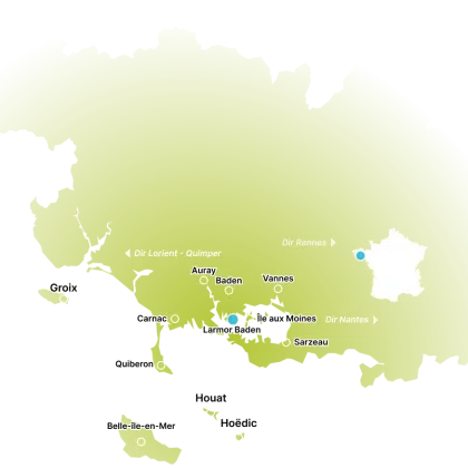
(D/A) Go to Port Blanc in the Gulf of Morbihan. From there, take the shuttle to Ile aux Moines. The crossing takes 5 minutes.
Once on the island, walk along the harbour to the end and continue straight on, staying on Rue Neuve until you reach a square.
At the end of this square, turn left onto Rue Yvon Cadet for 70m.
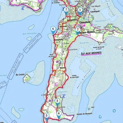
(1) Turn right into rue du Presbytère. Continue straight ahead for 420m, then turn left into rue du Naudeux. Just after the small buildings (on your left), take the right-hand path to the sea.
(2) Follow the coastal path. At PenHap, pass the Guip shipyard (3) and continue straight ahead on the Carlez road. At a jetty, take the coastal path to the right.
(4) Follow it for 450m, leaving the sea towards the end of the cove, to catch up with the Kerbozec road nearby.
(5) Go left and follow this road for about 170m. The road makes a right-angle bend (to the left). At this point, leave the road to take the path on the right.
(*) Alternatively, you can continue along this road to the very end of the island and see the dolmens. If you choose this option, return along the same road and at the second bend catch up with the path marked (*) above.
Assuming you’re on this path, you’ll reach the sea on the other side of the island. Follow the coastal path past Rudel. Continue along the coastal path until you come to the beautiful little Goret beach. Go around it and follow the path that diverges slightly from the sea.
Continue for 300m and at a house on your left (there’s also a house a little further up on the right), turn left to catch up with the coastal path. When you reach the sea, continue to the right and walk for about 300m.
(6) At a small headland, you come to the Route du Greignon, which you follow for 250m, away from the sea.
At the Y junction, take Rue du Gazolden (the left-hand road), follow it to a right-angle bend, continue and a little further on (approx. 70m), turn left into Rue de Rinville. This brings you to Rue du Dolmen, turn left and continue along this road. When you come to a small square in the middle of the road, turn left.
(7) Go straight on to take the coastal path. Further on, cross the beautiful Lerio beach (with its cabins) and stay alongside the sea on the coastal path (beware of a few tricky sections). You’ll then come to the port.
Take the same boat back to Port Blanc.
Passage points :
- D/A: km 0 – alt. 3m – Port Blanc
- 1: km 0.9 – alt. 14m – Rue du Presbytère
- 2: km 1.89 – alt. 4m – Coastal path
- 3: km 4.77 – alt. 16m – Chantier naval du Guip
- 4: km 5.18 – alt. 7m – Coastal path
- 5: km 5.69 – alt. 8m – Route de Kerbozec
- 6: km 9.59 – alt. 4m – Pointe Kergonan
- 7: km 10.74 – alt. 9m – Coastal path
- D/A: km 11.76 – alt. 3m – Port Blanc


